
Search an East Lansing Street
For a current East Lansing street directory search, normalize the number, directional, street name, suffix, unit, city, and ZIP first. The same road can be styled differently in a regional directory, especially near the university. Begin with the City of East Lansing BS&A search, which is available without charge at any time. It accepts an address, owner name, or parcel number. If an exact address misses, try the number and street name without a direction or suffix, then try the owner surname. Record the parcel number and keep the physical address separate from the owner mailing address.
- Use the address to identify the current parcel and the listed owner in BS&A.
- Open the East Lansing GIS map to compare the parcel shape, address, zoning, and nearby parcels.
- Take the owner name and legal-description clues to the Ingham Register of Deeds, then find the acquisition as a grantee record.
- Search the seller as a later grantee to work backward through earlier conveyances.
- Use a lawful voter request or the Michigan Voter Information Center only as a named-registration check, then use CADL address volumes for historic entries.
That order prevents a common error: treating the first name connected with a street address as proof of every person there. BS&A is parcel-oriented, and the recorder documents land instruments. A registration or historical directory has a different date and purpose.
East Lansing Street Directory Fields
The public BS&A entry point is the most direct way to turn an East Lansing street directory search into a parcel search. Its detailed-record option can lead to application-specific records. The parcel service and the map add fields that are useful for matching a result across systems. Save the parcel number exactly as displayed. It is the bridge from the city card to the map and to a deed search, although parcels can split or change over time.
| Assessor label | Type | When to use it | Record detail |
|---|---|---|---|
| Address | Search text | Start with number and street name | Try address variations when a full form fails. |
| Name | Search text | Check a listed owner | It is an owner-name route, not a full resident list. |
| Parcel Number | Search text | Join the map and card | Use the displayed ParcelNum or PAR_NO format. |
| Detailed Record Search | Link or mode | Narrow an application record | Its available details depend on the application. |
Note: A parcel-card date matters because assessment values and ownership displays can change after a new record is entered.
Map Each East Lansing Street
The city describes its GIS as a public view of parcels, zoning, tax districts, neighborhoods, socioeconomic data, and census layers. Search or click a parcel, then pan along the street and open the neighboring polygons. The public parcel FeatureServer exposes map fields including owner, owner mailing street, city, state, ZIP, street components, parcel number, zoning, classification, acreage, and assessed-value fields. Its popup information should be compared with the recorded legal description.
| GIS field | Street-directory use |
|---|---|
| ParcelNum / PAR_NO | Parcel identifier used to connect map, BS&A, and recorded land work. |
| Addr1 and street components | Situs or physical location fields, including prefix, name, suffix, and direction. |
| Owner and OwnerAddr / OwnerZip | Listed owner and tax-correspondence fields, not proof of occupancy at the situs. |
| Zoning and PropClass | Administrative and classification context for the mapped parcel. |
| Parent_Par, Split_YR, UNIT_NO, FLOORNO | Parcel-history or unit context that can explain a changed property relationship. |
A GIS parcel boundary is mapping geometry, not a legal survey. The service also carries parent-parcel, split-year, unit, and floor context for some records. Those fields can explain why one apparent street address has more than one parcel relationship. Use public map and query functions as a reader, not the service's edit capabilities.
The Ingham Register of Deeds online-records page shows the access paths that follow the parcel work.
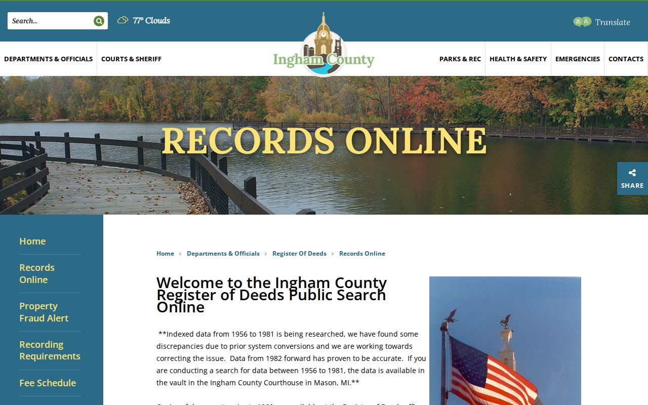
The recorder's access page is useful after a street-by-street worksheet has produced an owner name, parcel clue, or document reference.
Ingham Deeds on East Lansing Streets
Search a street parcel by parcel rather than relying on the street name in a deed index. Start with the current owner as grantee in Ingham Direct Search, identify the purchase instrument, then search that seller as grantee to find the seller's acquisition. Record the document number, book and page, recording date, party roles, instrument type, and legal description. A lot and block or other legal description usually remains more reliable than an address when a number, street label, or parcel configuration changes.
- Parcel
- A tax and mapping unit with a number used to connect the assessor, GIS, and land records. It can be split or replaced.
- Situs address
- The physical location attached to the parcel for maps, permits, and location services. It is distinct from correspondence information.
- Plat
- A recorded subdivision map that can identify lots, blocks, streets, easements, and later parcel relationships.
- Criss-cross directory
- A reverse directory arranged from address to listed occupant for a particular publication year.
Ingham's free Direct Search is an index from 1956 to the present, excluding the most recent seven days. The county describes online images as 1956 to current. Tapestry lists images from 1960 to current and charges $8.95 per search plus $1 per page. The county instructs researchers to verify 1956 through 1981 index hits in the Mason vault because conversion discrepancies exist; it states 1982 forward is accurate. Records before 1960 need a vault appointment. Mail copies cost $1 per page and go to P.O. Box 195, Mason, with a name, property description, book and page, or document number.
East Lansing Street Records by Address
Address-keyed sources each answer a limited question. Combining them gives a better East Lansing street directory trail without turning any single result into a claim it cannot support. The city owns the property and map layer, the county recorder keeps land instruments, and CADL preserves the address-oriented historic shelf.
| Record set | What it answers | Coverage and access | Important limit |
|---|---|---|---|
| BS&A assessor card | Current owner, situs, mailing address, parcel, and property fields | Free online search | It does not list every person at an address. |
| GIS parcel map | Parcels, zoning, tax, neighborhood, and map context | Free map and REST query | Geometry is not a legal survey. |
| Deed index and images | Grantor, grantee, instrument, legal description, and recording date | Direct Search, Tapestry, vault, or mail | Older online coverage needs vault checking. |
| Permits and code files | Project address, applicant, work, and chronology | Online applications; older files by request | An applicant does not establish an owner or resident. |
| CADL directories | Historical name or address listing | Address listings from 1906; reference and library routes | Each volume is a dated snapshot. |
The voter record has a narrower role. Michigan makes registration data public with field limits, while its public lookup is for a named voter. It cannot supply a complete household or street roster.
East Lansing Street Permit Clues
East Lansing permit applications in BS&A are keyed to an address. Building, electrical, mechanical, plumbing, paving, sign, right-of-way, water and sewer, and grading work can help date construction or a substantial change. The city construction-permits information describes the permit path, but the reviewed public material did not identify a complete historic permit or code-case index.
For an older permit or code matter, send the Planning and Building office a Michigan FOIA request that gives the exact address, parcel if known, date range, case type, and document description. An address-specific request is more likely to reach an existing file than a broad request. Keep the result as evidence of work or a filed case, not proof of who resided there.
Note: Verify a payment request through the official city contact because East Lansing issued a 2026 alert about impersonated planning bills.
Historic East Lansing Street Numbers
Old address work has a local obstacle. CADL documents three Lansing-area numbering eras: a first system from about 1867 to 1883 without block divisions, a second from about 1885 to 1905 using directional names and block numbers, and the Philadelphia or block plan adopted in 1906. There is no complete conversion key for the earlier systems. A modern number should never be imposed automatically on an older listing.
Copy the historic number and street spelling exactly, inspect the relevant Sanborn map, find the intersection or lot, and then compare the current parcel. CADL identifies Sanborn years for 1885, 1892, 1898, 1906, 1913, and 1926. The Library of Congress 1926 volume, republished in 1953, includes East Lansing and Meridian Township even though its title emphasizes Lansing.
East Lansing Street Directory History
For previous names tied to an address, CADL's city-directory guide points to address listings from 1906 to the present. The address section is the useful starting place after a parcel or historic street number has been established. It can add an owner or occupant notation, occupation, spouse clue, or nearby entries depending on the volume. Confirm a listed household with the land record and another dated source.
The Library of Congress inventory lists Lansing and East Lansing criss-cross directories for 1972 through 1996, with a gap in 1974 and 1975. CADL Forest Parke holds reference material and can help with year gaps or address-specific scans. For the collections and their annual details, use the East Lansing city directory page.
Voter Clues for East Lansing Streets
The Michigan Voter Information Center uses a first name, last name, birth month, and birth year for a public registration search. A Qualified Voter File request can be scoped to a jurisdiction, ward, or precinct, not a ZIP or published block mode. It may return fields such as complete name, residential or mailing address, year of birth, registration date, status, and requested history where available.
Michigan withholds the driver or state ID number, month and day of birth, phone, email, digitized signature, last four Social Security digits, and other protected fields. Registration is not evidence that every person at an address is registered, current, or visible. A change of status, a protected record, and ordinary nonregistration all limit the result.
East Lansing Street Privacy Limits
A street directory can identify a parcel owner, a recorded party, a registration result, or a dated directory entry. It cannot produce a complete list of people inside every address. Motor-vehicle address information is restricted under the Driver's Privacy Protection Act, and utility and delivery records are not public resident rolls. Owner mailing address and situs address also have different meanings: the first is tax correspondence, while the second locates the parcel. Neither proves occupancy.
Michigan's Address Confidentiality Program gives eligible participants a designated address and mail forwarding. When a result appears protected or sealed, stop the search rather than combining neighbor, land, directory, or family clues to find a physical address.